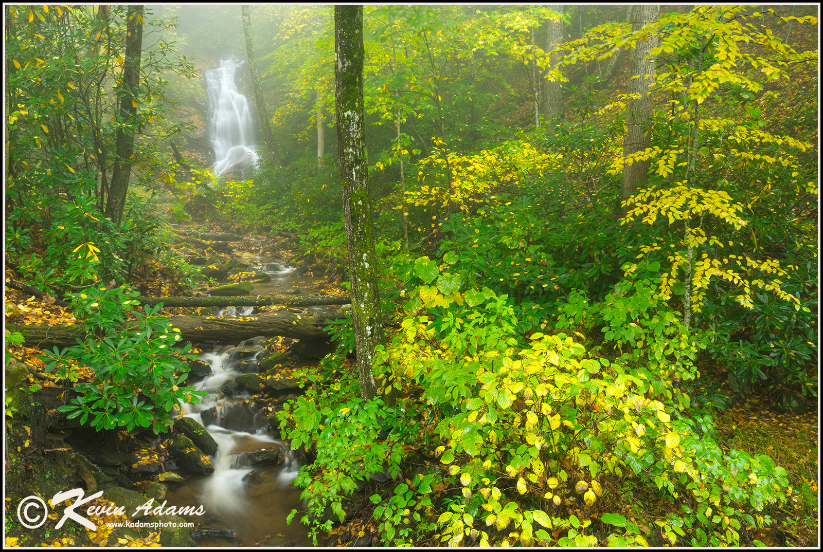
Log Hollow Falls 
Nikon D800, Nikon 24-70mm lens at 28mm, f/22, 5 seconds, ISO 200, polarizing filter.
 View waterfall on Google Earth. Link is for a Google Earth file. Click file after download and Google Earth will open and fly to the waterfall. Don't have Google Earth on your computer?
Driving Directions
From the junction of US 64, US 276, and NC 280 in Brevard, drive north on US 276 for 10.3 miles (passing Looking Glass Falls on the way) to the unpaved FR 475B (Headwaters Road), on the left. From the Blue Ridge Parkway, it is 4.7 miles to this point. Drive 1.6 miles on FR 475B to a sharp left-hand curve. Park on the outside of the curve at the forest management interpretive sign.
FR 475B continues 4.9 miles to FR 475 near the Bobby N. Setzer State Fish Hatchery. It passes Slick Rock Falls on the way.
Hike Description
A gated logging road (FR 5043) starts from the outside of the curve. Hike this road for an easy 0.22 mile to a wooden bridge over the creek. Just before the bridge is a small path on the right that leads about 0.25 mile to Discovery Falls. For Log Hollow Falls, continue on the old logging road to a second bridge. The waterfall is about 100 feet upstream. A path on the other side of the bridge leads to the base.
Overview
Log Hollow Falls used to be a perfect waterfall for those who wanted seclusion and an easy hike, but it has become popular in the 10 years since the last edition. I guess I’m largely to blame. Sorry about that. But if you visit during the week or early in the morning, you still stand a good chance of having the hike to yourself.
The Forest Service replaced the two bridges on FR 5043 shortly after the last edition. It used a type of treated wood that gives off a distinctive chemical odor. I expected the outgassing to end after a while, but it seems as strong as ever. You’ll definitely notice it. The second bridge makes a good viewing point for the falls, but I wouldn’t hang out on it long. And I sure as heck wouldn’t pitch a tent anywhere near it.
Just beyond the bridge is a path heading downstream that leads to FR 475B in 0.32 mile. If you use it and head back up the road, you can make a 1.25-mile loop hike. If you choose this route, you’ll come to a campsite 0.15 mile from the waterfall. Several paths lead off from the campsite. Take the one in the middle to reach FR 475B, at which point you’ll need to turn left to return to your car.