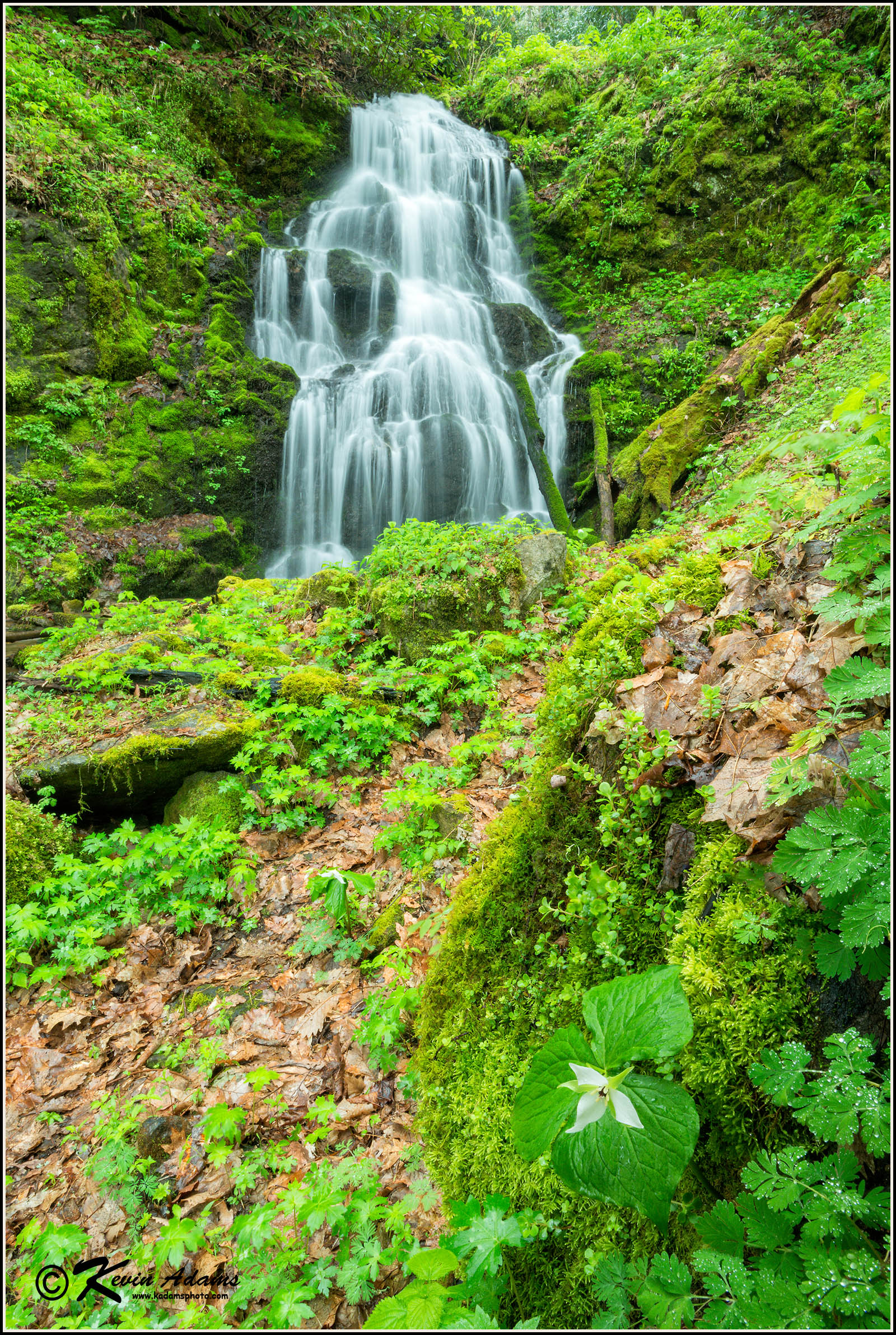
Trillium Falls 
Nikon D800, Nikon 17-35mm lens at 22mm, f/22, 1.3 seconds, ISO 400, polarizing filter. Photographed in rain.
 View waterfall on Google Earth. Link is for a Google Earth file. Click file after download and Google Earth will open and fly to the waterfall. Don't have Google Earth on your computer?
Driving Directions
From the junction of US 25/70 and NC 208 northeast of Hot Springs, head north on NC 208 for 3.45 miles and turn right on NC 212. Drive 12.55 miles and turn right on the unpaved Sugar Loaf Mountain Road. A sign here calls this a private road, but it appears to be open to the public for providing access to FR 275. The road forks at 0.3 mile. Go right. At 0.75 mile, you’ll reach the falls, on the left.
Overview
I called this one “Waterfall on Tributary of Hensley Branch” in the second edition of my North Carolina waterfalls book. I also listed it as being in Pisgah National Forest. Since then, I’ve learned the creek is really a tributary of Mill Creek, and that the waterfall probably is on private property. Chalk one up for GPS units and county GIS websites. As best I can determine, it’s okay to drive the road (a Forest Service official told me so), but you can’t leave it and walk closer to the falls. That’s okay, as you can see it just fine from the road.
In early spring, Trillium Falls is among my favorites. Several species of wildflowers grow all around the falls, including the white form of wake robin trillium (Trillium erectum), which gives the waterfall its name. In spring, when the creek is flowing well, the waterfall probably deserves a much higher beauty rating than 4.
NC 212 continues climbing the mountain from Sugarloaf Mountain Road and goes through a small but interesting plateau area. Instead of flowing off the mountain, the small branches that drain the plateau flow underground in a sinkhole. The road then crosses into Tennessee and climbs down the other side as TN 352. You can access I-26 that way for a return trip to North Carolina.